Sgorr a Chadail and Mullach an Rathain - Daniel and Clare's
photos (13th July 2011)
Echoes of fire, water, and a rare visionary: Liathach's
West end
[Summary: there is a
detailed version available].
|
[There's a route map on our
Walk Highlands website report
for this walk (at the bottom of the page).]
For us this was a special journey from an ultra-special place.
Reflections came to us in many ways: directly off the water,
less immediate hallmarks - of the recent fire on Liathach,
and distant but still poignant reminders of some of Torridon's history.
This year, would it be fourth time lucky to get onto Liathach - Liathach,
fearsome monolith which dominates iconic Torridon more than any other hill...? Yes, very -
though not in
the way we originally planned all those years ago:
Not to the highest point, the Spidean A Choire Leithe,
but to its other Munro, the Mullach an Rathain.
The west end of the Liathach ridge, Sgorr a Chadail, took our fancy:
It's a prominent feature from Corrie, particularly from Lochside Cottage,
where we were staying:
It looked like it could give
a spectacular bird's eye view of Loch Torridon.
We had also wondered for a while about climbing Mullach an Rathain from round
the back, up Coire Mhic Nobuill.
So we set off on foot from Lochside Cottage, on the Torridon House Estate,
on a perfect summer morning.
We followed the delightful shore road eastwards to the junction with the
public road from Fasag to Alligin, turned left and up the hill,
along and down to the bridge at Coire Mhic Nobuill. Many people start walks
on Beinn Alligin, or up the Coire to Coire Mhic Fhearchair or Beinn Dearg, from
this bridge: there's a layby adjacent on the south side.
On up the Coire Mhic Nobuill path until it crosses the Allt Coire Mhic
Nobuill (NG882589). Instead of crossing the bridge, we made our own
way more or less directly onto the ridge. Once there, it was easy walking
to the Sgorr, then along to the Mullach.
We returned to the road by a similar route, but carried on down the Allt
through the Torridon House estate, on a reasonably clear path through
the woods, joining the track from Rechullin back
to Lochside Cottage. As we emerged from the Corrie woods, the moon
was just over the mountains on the other side of Loch Torridon.
A beautiful day for us: we hope you enjoy the photos!
[To see any of the photos below at a bigger size, please
left-click on the (small)
photo in the table: You can step through the photos on the
enlarged display by using
the arrow keys; press Esc to quit the bigger display.
To make the enlarged display full-screen size, press F11. The full-screen
mode will take effect once you move to another photo.
Press F11 again to get it back to normal size,
etc.
Each box on this page is linked to
a self-contained slide-show. You can start the slides at any point in
a box clicking on any thumbnail]

Sgorr a Chadail from the Lochside Cottage jetty.
|

..and (sidelit) from outside the cottage. The summit of the Mullach
is just visible at the right-hand end of the photo.
|

Just before we set out to climb the Sgorr and the Mullach:
Clare enjoying the sun!
|

Beinn Damph (right), Beinn na h'Eaglaise (left) and Loch Torridon
at the start of the walk
|

Beinn Shieldaig from Lochside, at the start of the walk
|

..and from the Corrie road
|

The fish trap at Corrie (near shore)
|

The waterfall upstream from the Corrie road bridge
|


Woodland at the start of the Coire Mhic Nobuill path
|

The waterfall above the Coire Mhic Nobuill woods
|

Beinn Alligin from a little way up the Sgorr
|

Baosbheinn and the Suileagan ("eyes"), betwixt Alligin and Dearg
|

Gneiss hills above Wester Alligin, South Rona and Skye (north Trotternish) beyond..
|

..and the same view (from part-way up the Sgorr) in context
|
On Sgorr a Chadail:


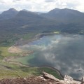
Upper Loch Torridon, its colours a rich combination of its own and
the sky's;
looking to Beinn Damph (left) and Beinn Shieldaig backed by the
Applecross hills (right)
Viewed like this, it's easy to forget that Loch Torridon
is a sea loch!
|

Looking east from the Sgorr, with fire-damaged south face, to the Mullach
|

Lichen with localised scorching (?)
|

..and again, though with alpine alchemilla already growing well
|

Submarine sediment from the Allt Coire Mhic Nobuill and the Corrie
delta, viewed from the Sgorr
|

Head of Loch Torridon, from the Sgorr: the Am Ploc fish trap,
by Fasag, is visible across the bottom left
bay of the Loch.
|

Beinn h'Eagleaise and Meall Chean Dearg, left of Beinn Damph,
across the loch;
The Sgorr's summit gives a bird's eye view of
the graceful shape of the loch's north shore
|

Looking further east at the sun-dappled mountains of the Coulin
Forest
|

The same view, closer in on Seana Mheallan (centre);
Skyline: Sgorr an Lochan Uaine (left), Beinn Liath Mhor (centre)
Sgurr Ruadh (right), with Fuar Tholl just to its right. Far right
are the hills to the south of Loch Carron.
A burnt plantation can be seen bottom right.
|

..and closer in, on Sgurr Ruadh, with Fuar Tholl
behind it to the right
|

Looking west down Loch Torridon, with the outer Loch, and beyond to
Skye; wind-patterns were appearing on the Loch,
and the cloud darkening, but
this was as thick as it got all day
|
On the way to Mullach an Rathain from the Sgorr:

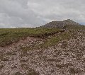
Sandy banks on the ridge
|

Sandy banks in alignment
|

Pancake-shaped sandstone at the tor
|

The summit of the Mullach from the false summit
|

The south spur of the Mullach, above Creag Dubh nan Fuaran -
sun on the quartzite foreground
contrasting with the Torridonian of the lower spur
|
Views from the Mullach, and on the descent:

Looking west down the ridge to the Sgorr; Beinn Alligin on the right,
Skye and Loch Torridon on the left
|
 Looking a little to the left: the width of the Mullach ridge,
from the south (left) spur, Creag
Dubh nan Fuaran, to the the tor - the light again
showing up the contrast 'twixt the ridge's shapeliness
and the abrupt change of rock type
|

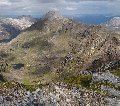
..and looking east along the pinnacles ridge to the
Spidean a Choire Leith, the highest point on Liathach, and for
many miles in all directions. The contrasts of light over the
Coulin forest mountains was particularly striking: the brightest
hills in the middle ground are Sgurr Dubh (left), and further right,
in line with the nearest foreground, Beinn Liath Beag. Sgorr an
Lochan Uaine is the higher, greyer summit to its right. Beinn Liath
Beag is some way further east than these other two.
|

Am Fasarinen. The distinctive shape at the centre of the
skyline is the compact group of hills south of the River Bran, between
Achnasheen and Achanalt (where we started this holiday!) -
Sgurr a Mhuilinn, etc.
|

The headwall of Coire na Caime
|

Closeup of Sgurr Dubh, rather belying its name from this angle
|

Closeup of the Coire a Cheud Chnoc (Corrie of a hundred hills),
and the folds on Sgorr an Lochan Uaine
|

..and a little further to the right: Sgorr an Lochan Uaine,
Beinn Liath Mhor, and Sgurr Ruadh (with Fuar Tholl just behind it,
in shadow). In the centre of
the photo is Lochan Neimhe - a most atmospheric place.
|

Red admiral on the summit of Mullach an Rathain
(very quick photo, hence the blur! Still, something
of the striking colour can be seen).
|

Large emerald in Glen Torridon (near Glen Cottage), at the foot
of Liathach (east)
|

Blue butterfly (underside) on the shore road verges near
Lochside cottage (2010), at the foot of Liathach (west)
|

Between Beinn Alligin and Beinn Dearg to Loch Gairloch,
looking across the west and east (Northern
Pinnacles) sides of Glas-Toll a'Bothain
|

Beinn Dearg: behind Baosbheinn (left), Loch na h'Oidhche, and, right,
the pointed summit of Beinn an Eoin. Lochan Carn na Feola is on the
extreme right.
|

A broader view across Glas-Toll a'Bothain - both sides of the
Glas showing a striking profile. Loch nan Cabar and Loch Grobaig
are visible on the right
|

The Northern Pinnacles leading down to Loch Coire na Caime;
Beinn Eighe beyond the Northern Pinnacles, on the right,
with Beinn A'Cheircaill to its left.
|

The Cuillins of Skye on the left skyline: Raasay's Dun Caan is
the small prominent table-top to the right of centre. Dun Caan
is a small hill for this region, yet is one of the most visible,
with a profile that seems similarly distinctive from many
different angles.
|

Meall Chean Dearg looked particularly striking from lower
down the ridge
|

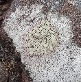
We saw examples of this lichen in other places nearby. This
is near the saddle: the photo also shows some quite coarse
texture in the Torridonian sandstone.
|

Slioch, majestic as ever, in the centre of this photo. The "spear",
which gives this hill its name, Sgurr an Tuill Bhain, is visible here,
(the shallow, sharp point to the right of centre on the skyline).
It isn't from the more usual views of Slioch, taken with Loch
Maree as a foreground, from further north. This Sgurr is the
other end of the horseshoe, the ridge between being completely safe
but very exciting. It was our first munro, in 1997, walking
the ridge late on a russet midsummer evening. We got back to the
chalet in Kinlochewe at 2 a.m., having seen the last of the light
over Loch Maree, accompanied by a sandpiper's calls. We're not in
any sense out to climb Munros - just as well as doing them all
would take us about 200 years at the current rate, but Slioch was
one of our best walks and it remains a special place for us.
|

The bright evening sun picked up the details of Beinn Dearg's
southern face. The bright green patches near the Allt Coire
Mhic Nobuill, at the foot of the Beinn, were once shieling areas.
|
Finally: a secluded final part of the walk: dusk, a glimpse of the past,
emergence from the woods to the moon...

The cross on top of the Darroch memorial, with Coire Church and Beinn
Alligin behind.
(2010)
|

Loch Torridon from the Darroch memorial
(2010)
|

Beinn Shieldaig across Loch Torridon, from the track between Torridon
House and Corrie church
(2010)
|

Torridon House - a large building for such a remote place,
but with these woodlands and
its magnificent backdrop, it seems to fit in somehow (2010)
|

Lichen nearby
|

Moonrise between Beinn Damph and Beinn na h'Eaglaise,
at the end of our walk on Mullach an Rathain
|
(Text and photos by Daniel and Clare Gordon. September 2011).
Please e-mail any requests or comments about this site
to us at our home address,
if you have it. Otherwise please use Daniel's
university address,
D.R.H.Gordon@leeds.ac.uk.
Thank you.
This web site is written and maintained by
Daniel Gordon, and hosted by
United Hosting.
[© D./C.G. 2025]


